

Select Category
Cartography
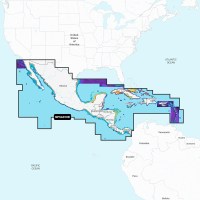
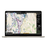
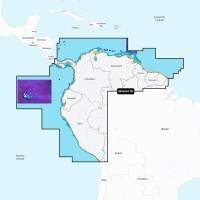
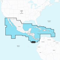
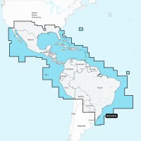
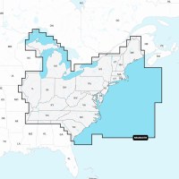
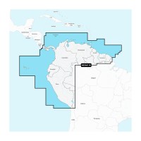
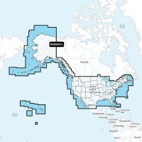
Navionics Platinum+ NPSA010R - Central America & Caribbean
Navionics Platinum Plus, Navionics Platinum Plus Foreign, Navionics
$296.23
You save:
$98.75
Platinum+ NPSA010R - Central America & Caribbean Get the world’s No. 1 choice in marine mapping - with the best, most up-to-date Navionics+ cartography on a compatible chartplotter. For offshore or i...
More Details
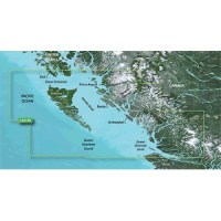
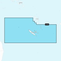
Garmin BlueChart® g3 Vision® HD - VCA019R - Hecate Strait - microSD™/SD™
Garmin BlueChart Vision, Garmin BlueChart Vision Foreign, Garmin
$568.19
BlueChart® g3 Vision® HD - VCA019R - Hecate Strait - microSD™/SD™ Coverage: Hecate Strait and the surrounding waters, specifically: Hecate Island, the British Columbia coast from Prince Rupert to Port...
More Details
Garmin BlueChart® g3 Vision® HD - VCA018R - Inside - Outside Passage - microSD™/SD™
Garmin BlueChart Vision, Garmin BlueChart Vision Foreign, Garmin
$568.19
BlueChart® g3 Vision® HD - VCA018R - Inside - Outside Passage - microSD™/SD™ Coverage: Inside and Outside Passages around Vancouver Island, specifically: the Strait of Juan de Fuca, the Johnstone Stra...
More Details
LightHouse Chart North America LightHouse Charts North America chart coverage includes coastlines of the contiguous United States, Alaska, Hawaii, thousands of inland freshwater bodies of water, and t...
More Details
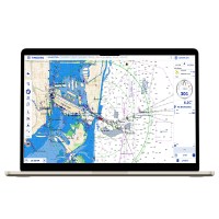
Weather Routing Module Download Navigate Safely & Efficiently Like all sailors know, the most direct route isn't always the best one. The Routing Module now combines its revolutionary algorithm, allow...
More Details
WASSP Module Digital Download The Unprecedented Commercial Fishing Solution The TZ WASSP Plus Pack allows you to integrate the cutting-edge WASSP Sounder with TZ Professional for an unrivaled commerci...
More Details
VDR Module Digital Download Data recording made simple. Save your data from previous trips up to one month. The Voyage Data Recorder Module, which comes as an option, offers the possibility to save al...
More Details

Upgrade from TZ Previous Versions to TZ Navigator TZ Navigator software has been designed to answer the navigation needs and requirements of recreational sailors. With truly cutting-edge features, it ...
More Details
Upgrade From TZ Navigator to TZ Professional Valid 1-Year This is a digital download. Please include your existing TZ Navigator serial number along with your email address, and the new unlock code wil...
More Details

Update From TZ Pro To New Version - Digital Download Charts not included This is a digital download, please include your your email address with your order and the new unlock code will be sent via em...
More Details

Nobeltec TZ Professional Software - Digital Download - Charts Not Included
NOBELTEC, Nobeltec
$2,808.89
TZ Professional Software - Digital Download - Charts Not Included Charts not included This is a digital download, please include your your email address with your order and the new unlock code will b...
More Details

TZ Professional Additional Workstation - Digital Download Whether for Commercial Fishing or a Workboat TZ Professional version 3 is the latest version of our marine navigation software and the sole pr...
More Details

TZ Navigator Digital Download - No Charts Included Nobeltec's redesigned user interface will make your life much easier when it comes to route planning and all the features you are familiar with (Tide...
More Details
TZ Navigator Additional Work Station Nobeltec's redesigned user interface will make your life much easier when it comes to route planning and all the features you are familiar with (Tides, Currents, W...
More Details
S57/S63 Module Digital Download Keeping up-to-date charts is an essential element to ensure the safety of all those at sea. TZ Professional is now compatible with the official S57/S63 formats. The off...
More Details
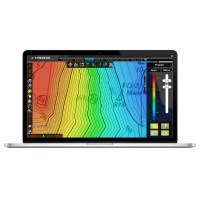
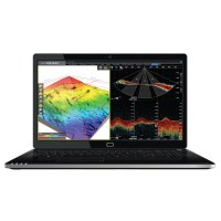
PBG Module Download The latest version of the PBG module will allow you to create charts of the seafloor even more clearly and realistically. The 2D and 3D imaging will now have customizable color cod...
More Details
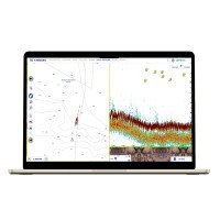
Furuno Sounder Module Download Maximize navigation security and your fishing potential by integrating TIMEZERO software with an Ethernet-based Furuno Sounder. The Furuno sounder models DFF1, DFF3, DFF...
More Details
Furuno Radar Module Download INTEGRATE TIMEZERO SOFTWARE WITH BEST-IN-CLASS FURUNO RADARS AND MFDS The Furuno Radar Plus Pack allows the user to make the most of compatible FURUNO radars and MFDs. Com...
More Details
Furuno DFF3D Sounder Module Download - PBG Module Required Map the seafloor of your fishing area in just a few passes. 50 depth points per second, your time has never been so valuable! Instead of spe...
More Details
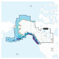
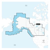
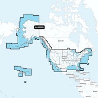
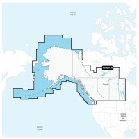
Platinum+ NPUS013R - Canada, West & Alaska Get the world’s No. 1 choice in marine mapping - with the best, most up-to-date Navionics+ cartography on a compatible chartplotter. For offshore or inland ...
More Details
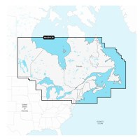
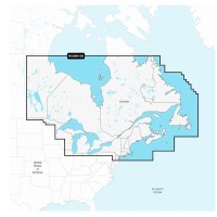
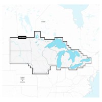
Navionics Platinum+ NPUS012R - Canada, East & Great Lakes
Navionics Platinum Plus, Navionics
$405.84
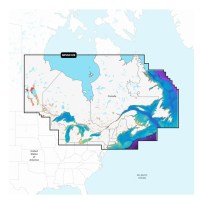
Platinum+ NPUS012R - Canada, East & Great Lakes Get the world’s No. 1 choice in marine mapping - with the best, most up-to-date Navionics+ cartography on a compatible chartplotter. For offshore or in...
More Details
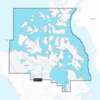
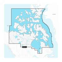
Navionics Platinum+ NPUS011R - Canada North
Navionics +, Navionics + ROW, Navionics
$296.23
You save:
$98.75
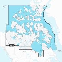
Platinum+ NPUS011R - Canada North Get the world’s No. 1 choice in marine mapping - with the best, most up-to-date Navionics+ cartography on a compatible chartplotter. For offshore or inland waters, t...
More Details
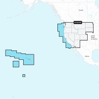
Navionics Platinum+ NPUS008R - U.S. West
Navionics Platinum Plus, Navionics
$296.23
You save:
$98.75
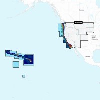
NPUS008R - U.S. West Get the world’s No. 1 choice in marine mapping - with the best, most up-to-date Navionics Platinum+ cartography on your compatible chartplotter. For offshore or inland waters, th...
More Details
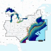
Navionics Platinum+ NPUS007R - U.S. East
Navionics Platinum Plus, Navionics
$296.23
You save:
$98.75
NPUS007R - U.S. East Get the world’s No. 1 choice in marine mapping - with the best, most up-to-date Navionics Platinum+ cartography on your compatible chartplotter. For offshore or inland waters, th...
More Details
Navionics Platinum+ NPUS006R - U.S. South
Navionics Platinum Plus, Navionics
$296.23
You save:
$98.75
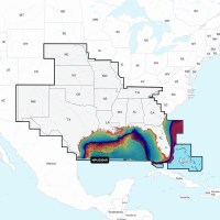
NPUS006R - U.S. South Get the world’s No. 1 choice in marine mapping - with the best, most up-to-date Navionics Platinum+ cartography on your compatible chartplotter. For offshore or inland waters, t...
More Details
Navionics Platinum+ NPUS005R - U.S. North
Navionics Platinum Plus, Navionics
$296.23
You save:
$98.75
NPUS005R - U.S. North Get the world’s No. 1 choice in marine mapping - with the best, most up-to-date Navionics Platinum+ cartography on your compatible chartplotter. For offshore or inland waters, t...
More Details
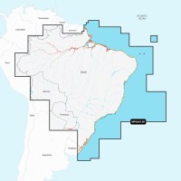
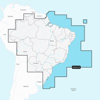
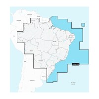
Navionics Platinum+ NPSA012R - Brazil
Navionics Platinum Plus Foreign, Navionics
$296.23
You save:
$98.75
Platinum+ NPSA012R - Brazil Get the world’s No. 1 choice in marine mapping - with the best, most up-to-date Navionics+ cartography on a compatible chartplotter. For offshore or inland waters, this al...
More Details
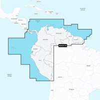
Navionics Platinum+ NPSA011R - South America North
Navionics Platinum Plus Foreign, Navionics
$296.23
You save:
$98.75
Platinum+ NPSA011R - South America North Get the world’s No. 1 choice in marine mapping - with the best, most up-to-date Navionics+ cartography on a compatible chartplotter. For offshore or inland wa...
More Details

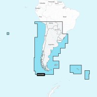
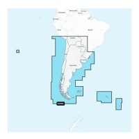
Navionics Platinum+ NPSA005L - Chile, Argentina & Easter Island
Navionics Platinum Plus, Navionics
$487.01
You save:
$144.97
NPSA005L - Chile, Argentina and Easter Island Get the world’s No. 1 choice in marine mapping - with the best, most up-to-date Navionics Platinum+ cartography on your compatible chartplotter. For offs...
More Details
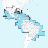
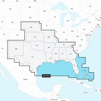
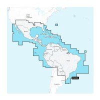
Navionics Platinum+ NPSA004L - Mexico, Caribbean to Brazil
Navionics Platinum Plus, Navionics
$487.01
You save:
$144.97
NPSA004L - Mexico, Caribbean to Brazil Get the world’s No. 1 choice in marine mapping - with the best, most up-to-date Navionics Platinum+ cartography on your compatible chartplotter. For offshore or...
More Details
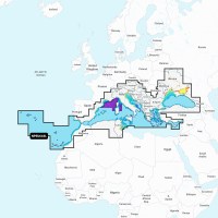
Navionics NPEU643L - Mediterranean & Black Sea - Navionics Platinum+
Navionics Platinum Plus Foreign, Navionics
$458.66
You save:
$94.32
NPEU643L - Mediterranean & Black Sea - Navionics Platinum+ Navionics Platinum+™ charts include all the content of Navionics®+ cartography, with integrated offshore and inland mapping, 42,000+ lakes, a...
More Details
Navionics NAUS013R - Canada, West & Alaska - Navionics+
Navionics +, Navionics
$177.73
You save:
$59.25
NAUS013R - Canada, West & Alaska - Navionics+ Get the world’s No. 1 choice in marine mapping - with the best, most up-to-date Navionics+ cartography on your compatible chartplotter. For offshore or i...
More Details
Navionics NAUS012R - Canada, East & Great Lakes - Navionics+
Navionics +, Navionics
$177.73
You save:
$59.25
NAUS012R - Canada, East & Great Lakes - Navionics+ Get the world’s No. 1 choice in marine mapping - with the best, most up-to-date Navionics+ cartography on your compatible chartplotter. For offshore...
More Details
NAUS011R - Canada North - Navionics+ Get the world’s No. 1 choice in marine mapping - with the best, most up-to-date Navionics+ cartography on a compatible chartplotter. For offshore or inland waters...
More Details

NAUS008R - U.S. West - Navionics+ Get the world’s No. 1 choice in marine mapping - with the best, most up-to-date Navionics+ cartography on your compatible chartplotter. For offshore or inland waters...
More Details

NAUS007R - U.S. East - Navionics+ Get the world’s No. 1 choice in marine mapping - with the best, most up-to-date Navionics+ cartography on your compatible chartplotter. For offshore or inland waters...
More Details

NAUS006R - U.S. South - Navionics+ Get the world’s No. 1 choice in marine mapping - with the best, most up-to-date Navionics+ cartography on your compatible chartplotter. For offshore or inland water...
More Details
NAUS005R - U.S. North - Navionics+ Get the world’s No. 1 choice in marine mapping - with the best, most up-to-date Navionics+ cartography on your compatible chartplotter. For offshore or inland water...
More Details
Navionics NAUS001L - U.S. & Coastal Canada - Navionics+
Navionics +, Navionics
$243.50
You save:
$72.48
NAUS001L - U.S. & Coastal Canada - Navionics+ Get the world’s No. 1 choice in marine mapping - with the best, most up-to-date Navionics+ cartography on your compatible chartplotter. For offshore or i...
More Details
NASA012R - Brazil - Navionics+ Get the world’s No. 1 choice in marine mapping - with the best, most up-to-date Navionics+ cartography on a compatible chartplotter. For offshore or inland waters, this...
More Details
Navionics NASA011R - South America North - Navionics+
Navionics + ROW, Navionics
$177.73
You save:
$59.25
NASA011R - South America North - Navionics+ Get the world’s No. 1 choice in marine mapping - with the best, most up-to-date Navionics+ cartography on a compatible chartplotter. For offshore or inland...
More Details
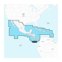
Navionics NASA010R - Central America & Caribbean - Navionics+
Navionics +, Navionics + ROW, Navionics
$177.73
You save:
$59.25
NASA010R - Central America & Caribbean - Navionics+ Get the world’s No. 1 choice in marine mapping - with the best, most up-to-date Navionics+ cartography on a compatible chartplotter. For offshore o...
More Details
Navionics NASA005L - Chile, Argentina & Easter Island - Navionics+
Navionics +, Navionics
$243.50
You save:
$72.48
NASA005L - Chile, Argentina & Easter Island - Navionics+ Get the world’s No. 1 choice in marine mapping - with the best, most up-to-date Navionics+ cartography on your compatible chartplotter. For of...
More Details
Navionics NASA004L - Mexico, Caribbean to Brazil - Navionics+
Navionics +, Navionics
$243.50
You save:
$72.48
NASA004L - Mexico, Caribbean to Brazil - Navionics+ Get the world’s No. 1 choice in marine mapping - with the best, most up-to-date Navionics+ cartography on your compatible chartplotter. For offsho...
More Details
NAPC030R - New Caledonia - Navionics+ Get the world’s No. 1 choice in marine mapping - with the best, most up-to-date Navionics+ cartography on your compatible chartplotter. For offshore or inland wa...
More Details
NAPC029R - New Zealand - Navionics+ Get the world’s No. 1 choice in marine mapping - with the best, most up-to-date Navionics+ cartography on your compatible chartplotter. For offshore or inland wate...
More Details
Navionics NAPC028R - Australia, Southeast - Navionics+
Navionics + ROW, Navionics
$155.76
You save:
$49.62
NAPC028R - Australia, Southeast - Navionics+ Get the world’s No. 1 choice in marine mapping - with the best, most up-to-date Navionics+ cartography on your compatible chartplotter. For offshore or in...
More Details
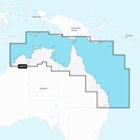
Navionics NAPC027R - Australia, Northeast - Navionics+
Navionics + ROW, Navionics
$155.76
You save:
$49.62
NAPC027R - Australia, Northeast - Navionics+ Get the world’s No. 1 choice in marine mapping - with the best, most up-to-date Navionics+ cartography on your compatible chartplotter. For offshore or in...
More Details
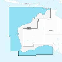
Navionics NAPC026R - Australia, West - Navionics+
Navionics + ROW, Navionics
$155.76
You save:
$49.62
NAPC026R - Australia, West - Navionics+ Get the world’s No. 1 choice in marine mapping - with the best, most up-to-date Navionics+ cartography on your compatible chartplotter. For offshore or inland ...
More Details
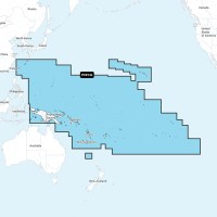
Navionics NAPC014L - Pacific Islands - Navionics+
Navionics + ROW, Navionics
$308.43
You save:
$70.75
NAPC014L - Pacific Islands - Navionics+ Get the world’s No. 1 choice in marine mapping - with the best, most up-to-date Navionics+ cartography on your compatible chartplotter. For offshore or inland ...
More Details
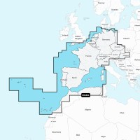
Navionics NAEU646L - Europe, Central & West - Navionics+
Navionics + ROW, Navionics
$324.67
You save:
$70.31
NAEU646L - Europe, Central & West - Navionics+ Get the world’s No. 1 choice in marine mapping - with the best, most up-to-date Navionics+ cartography on a compatible chartplotter. For offshore or inl...
More Details
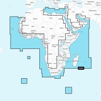
Navionics NAAF630L - Africa & Middle East - Navionics+
Navionics + ROW, Navionics
$324.67
You save:
$70.31
NAAF630L - Africa & Middle East - Navionics+ Get the world’s No. 1 choice in marine mapping - with the best, most up-to-date Navionics+ cartography on a compatible chartplotter. For offshore or inla...
More Details
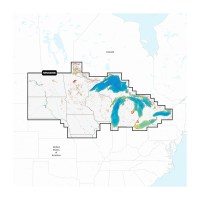
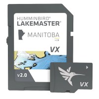
LakeMaster® VX Premium Manitoba V2.0 Humminbird® LakeMaster® Maps deliver unrivaled detail, accuracy, and innovative, one-of-a-kind features you need to eliminate unproductive water and find the best ...
More Details
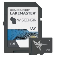
LakeMaster® VX Premium - Wisconsin An upgraded premium mapping solution in Humminbird LakeMaster VX to help anglers understand what is under the water’s surface better than ever before. For decades, H...
More Details
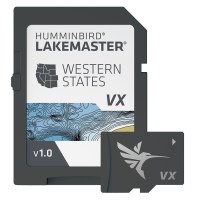
LakeMaster® VX Premium - Western States An upgraded premium mapping solution in Humminbird LakeMaster VX to help anglers understand what is under the water’s surface better than ever before. For decad...
More Details
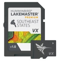
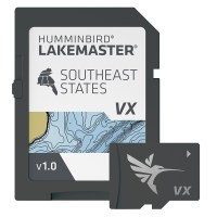
LakeMaster® VX Premium - Southeast An upgraded premium mapping solution in Humminbird LakeMaster VX to help anglers understand what is under the water’s surface better than ever before. For decades, H...
More Details
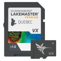
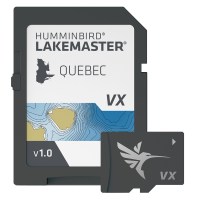
LakeMaster® VX Premium - Quebec An upgraded premium mapping solution in Humminbird LakeMaster VX to help anglers understand what is under the water’s surface better than ever before. For decades, Humm...
More Details
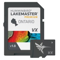
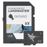
LakeMaster® VX Premium - Ontario An upgraded premium mapping solution in Humminbird LakeMaster VX to help anglers understand what is under the water’s surface better than ever before. For decades, Hum...
More Details
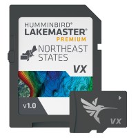
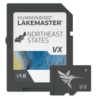
LakeMaster® VX Premium - Northeast An upgraded premium mapping solution in Humminbird LakeMaster VX to help anglers understand what is under the water’s surface better than ever before. For decades, H...
More Details
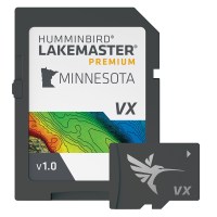
LakeMaster® VX Premium - Minnesota An upgraded premium mapping solution in Humminbird LakeMaster VX to help anglers understand what is under the water’s surface better than ever before. For decades, H...
More Details
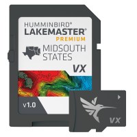
LakeMaster® VX Premium - Mid-South States An upgraded premium mapping solution in Humminbird LakeMaster VX to help anglers understand what is under the water’s surface better than ever before. For dec...
More Details
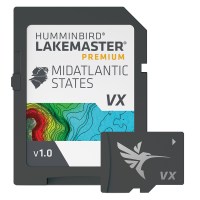
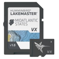
LakeMaster® VX Premium - Mid-Atlantic States An upgraded premium mapping solution in Humminbird LakeMaster VX to help anglers understand what is under the water’s surface better than ever before. For ...
More Details
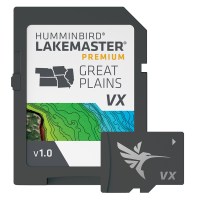
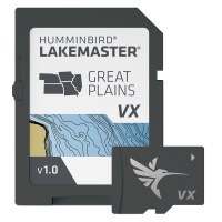
LakeMaster® VX Premium - Great Plains An upgraded premium mapping solution in Humminbird LakeMaster VX to help anglers understand what is under the water’s surface better than ever before. For decades...
More Details
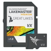
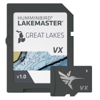
LakeMaster® VX Premium - Great Lakes An upgraded premium mapping solution in Humminbird LakeMaster VX to help anglers understand what is under the water’s surface better than ever before. For decades,...
More Details
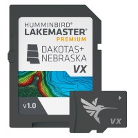
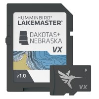
LakeMaster® VX Premium - Dakota/Nebraska An upgraded premium mapping solution in Humminbird LakeMaster VX to help anglers understand what is under the water’s surface better than ever before. For deca...
More Details
LakeMaster® VX Manitoba V2.0 Humminbird® LakeMaster® Maps deliver unrivaled detail, accuracy, and innovative, one-of-a-kind features you need to eliminate unproductive water and find the best fishing ...
More Details
LakeMaster® VX - Wisconsin An upgraded mapping solution in Humminbird LakeMaster VX to help anglers understand what is under the water’s surface better than ever before. For decades, Humminbird LakeMa...
More Details
LakeMaster® VX - Western States An upgraded mapping solution in Humminbird LakeMaster VX to help anglers understand what is under the water’s surface better than ever before. For decades, Humminbird L...
More Details
LakeMaster® VX - Southeast States An upgraded mapping solution in Humminbird LakeMaster VX to help anglers understand what is under the water’s surface better than ever before. For decades, Humminbird...
More Details
LakeMaster® VX - Quebec An upgraded mapping solution in Humminbird LakeMaster VX to help anglers understand what is under the water’s surface better than ever before. For decades, Humminbird LakeMaste...
More Details
LakeMaster® VX - Ontario An upgraded mapping solution in Humminbird LakeMaster VX to help anglers understand what is under the water’s surface better than ever before. For decades, Humminbird LakeMast...
More Details
LakeMaster® VX - Northeast States An upgraded mapping solution in Humminbird LakeMaster VX to help anglers understand what is under the water’s surface better than ever before. For decades, Humminbird...
More Details
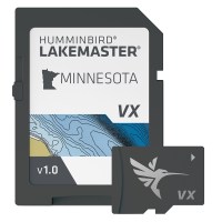
LakeMaster® VX - Minnesota An upgraded mapping solution in Humminbird LakeMaster VX to help anglers understand what is under the water’s surface better than ever before. For decades, Humminbird LakeMa...
More Details
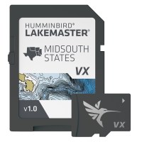
LakeMaster® VX - Mid-South States An upgraded mapping solution in Humminbird LakeMaster VX to help anglers understand what is under the water’s surface better than ever before. For decades, Humminbird...
More Details
LakeMaster® VX - Mid-Atlantic States An upgraded mapping solution in Humminbird LakeMaster VX to help anglers understand what is under the water’s surface better than ever before. For decades, Humminb...
More Details
LakeMaster® VX - Great Plains An upgraded mapping solution in Humminbird LakeMaster VX to help anglers understand what is under the water’s surface better than ever before. For decades, Humminbird Lak...
More Details
LakeMaster® VX - Great Lakes An upgraded mapping solution in Humminbird LakeMaster VX to help anglers understand what is under the water’s surface better than ever before. For decades, Humminbird Lake...
More Details
LakeMaster® VX - Dakotas/Nebraska An upgraded mapping solution in Humminbird LakeMaster VX to help anglers understand what is under the water’s surface better than ever before. For decades, Humminbird...
More Details
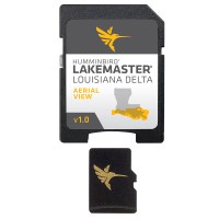
LakeMaster Aerial Satellite View - Louisiana Delta Humminbird® LakeMaster® now offers high resolution aerial photography of the Louisiana Delta on one micro card (with SD adaptor). Always know where y...
More Details
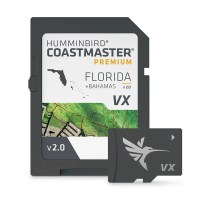
CoastMaster™ Premium Edition - Florida - Version 2 Humminbird® CoastMaster® Premium Florida V2 with Bahamas provides highly accurate chart coverage for all Florida waters. It also includes boat lanes ...
More Details
Coastmaster™ Chart Plan Your Attack Find the path to your next big catch with the incredible accuracy and detail of Humminbird® CoastMaster™. With easy-to-read contours and chart customization, you'll...
More Details
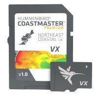
CoastMaster® Premium Northeast Coastal V1 Find the path to your next big catch with the incredible accuracy and detail of Humminbird® CoastMaster® Premium Northeast Coastal, providing highly accurate ...
More Details
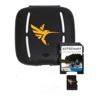
AutoChart Zero Lines Map Card The Zero Lines map card is the starting point for building your maps with AutoChart or AutoChart Live. With these all-important Zero Lines as your foundation, you can beg...
More Details
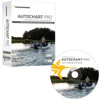
Humminbird AutoChart PRO DVD PC Mapping Software w/Zero Lines Map Card
Humminbird, Humminbird
$394.98
AutoChart PRO™ DVD PC Mapping Software with Zero Lines Map Card AutoChart PRO™: Add another layer of detail to your cartography. Humminbird AutoChart PRO™ for North America offers all the leading feat...
More Details
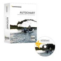
AutoChart DVD PC Mapping Software with Zero Lines Map Card AutoChart: Map coverage where you make it. Humminbird AutoChart for North America uses proprietary software that takes your Humminbird's sona...
More Details
Garmin VEU722L Europe Atlantic Coast BlueChart® g3 Vision®
Garmin BlueChart Vision Foreign, Garmin
$568.19
VEU722L Europe Atlantic Coast BlueChart® g3 Vision® Detailed coverage of the Atlantic and Mediterranean coast of Western Europe, the British Isles and northwestern Africa. Coverage includes the Azores...
More Details
Garmin NVEU010R Spain, Mediterranean Coast - Marine Charts Garmin Navionics Vision+
Garmin Navionics Vision+ - Foreign, Garmin
$296.23
You save:
$98.75
NVEU010R Spain, Mediterranean Coast - Marine Charts Garmin Navionics Vision+ Garmin Navionics Vision+™ | NVEU010R | microSD™/SD™ and One-year Subscription It's a whole new look on your chartplotter. F...
More Details
Garmin Navionics+™ NSUS013R Canada, West & Alaska
Garmin Navionics+, Garmin
$177.73
You save:
$59.25
Navionics+™ NSUS013R Canada, West & Alaska Featuring vibrant colors, a streamlined interface, and combined coastal/inland content with a popular Navionics® style color palette, Garmin Navionics+ carto...
More Details
Garmin Navionics+™ NSUS012R Canada, East & Great Lakes
Garmin Navionics+, Garmin
$177.73
You save:
$59.25
Navionics+™ NSUS012R Canada, East & Great Lakes Featuring vibrant colors, a streamlined interface, and combined coastal/inland content with a popular Navionics® style color palette, Garmin Navionics+ ...
More Details
Navionics+™ NSUS011R Canada North Featuring vibrant colors, a streamlined interface, and combined coastal/inland content with a popular Navionics® style color palette, Garmin Navionics+ cartography ma...
More Details
Garmin Navionics+™ NSUS008R U.S. West Get the world’s No. 1 choice in the marine mapping (based on 2020 reported sales) — with the best, most up-to-date Navionics®+ cartography on your compatible char...
More Details
Garmin Navionics+™ NSUS007R U.S. East Get the world’s No. 1 choice in the marine mapping (based on 2020 reported sales) — with the best, most up-to-date Navionics®+ cartography on your compatible char...
More Details
Garmin Navionics+™ NSUS006R U.S. South Get the world’s No. 1 choice in the marine mapping (based on 2020 reported sales) — with the best, most up-to-date Navionics®+ cartography on your compatible cha...
More Details
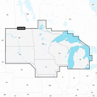
Garmin Navionics+™ NSUS005R U.S. North & Great Lakes
Garmin Navionics+, Garmin
$177.73
You save:
$59.25
Navionics+™ NSUS005R U.S. North & Great Lakes Get the world’s No. 1 choice in marine mapping (based on 2020 reported sales) — with the best, most up-to-date Navionics®+ cartography on your compatible ...
More Details
Navionics+™ NSSA012R Brazil Featuring vibrant colors, a streamlined interface, and combined coastal/inland content with a popular Navionics® style color palette, Garmin Navionics+ cartography makes it...
More Details
Garmin Navionics+™ NSSA011R South America (North)
Garmin Navionics+ Foreign, Garmin
$177.73
You save:
$59.25
Navionics+™ NSSA011R South America (North) Featuring vibrant colors, a streamlined interface, and combined coastal/inland content with a popular Navionics® style color palette, Garmin Navionics+ carto...
More Details
Garmin Navionics+™ NSSA010R Central America & Caribbean
Garmin Navionics+ Foreign, Garmin
$177.73
You save:
$59.25
Navionics+™ NSSA010R Central America & Caribbean Featuring vibrant colors, a streamlined interface, and combined coastal/inland content with a popular Navionics® style color palette, Garmin Navionics+...
More Details
Garmin Navionics+™ NSSA005L - Chile, Argentina & Easter Island - Marine Chart
Garmin Navionics+ Foreign, Garmin
$243.50
You save:
$72.48
Navionics+™ NSSA005L - Chile, Argentina and Easter Island - Marine Chart Get the world’s No. 1 choice in the marine mapping with the best, most up-to-date Navionics®+ cartography on your compatible c...
More Details
Garmin Navionics+™ NSSA004L - Mexico, the Caribbean to Brazil - Inland & Coastal Marine Chart
Garmin Navionics+ Foreign, Garmin
$243.50
You save:
$72.48
Navionics+™ NSSA004L - Mexico, the Caribbean to Brazil - Inland & Coastal Marine Chart Get the world’s No. 1 choice in the marine mapping with the best, most up-to-date Navionics®+ cartography on your...
More Details
Garmin Navionics+™ BUS001L U.S. & Coastal Canada Built-In Chart Updates - microSD™/SD™ & 1-Year Subscription
Garmin Navionics+, Garmin
$243.50
You save:
$72.48
Navionics+™ BUS001L U.S. & Coastal Canada Built-In Chart Updates - microSD™/SD™ & 1-Year Subscription UPDATE TO GARMIN NAVIONICS+™ CARTOGRAPHY If your chartplotter came with built-in BlueChart® g3 coa...
More Details