

Select Category
_0x200.jpg)
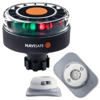
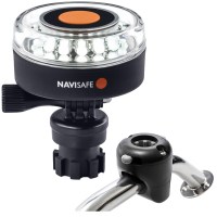
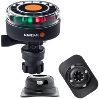
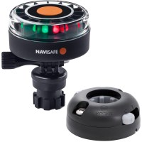
Navisafe Navilight Tricolor 2NM with RAILBLAZA Base
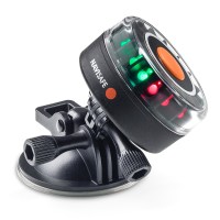
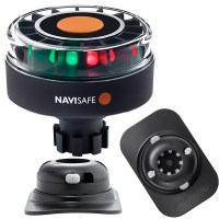
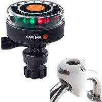
Navisafe Navilight Tricolor 2NM w/Suction Base
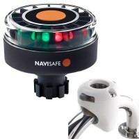
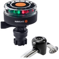
Navisafe Navilight Tricolor 2NM w/Scotty Base
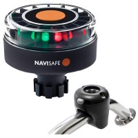
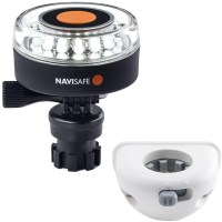
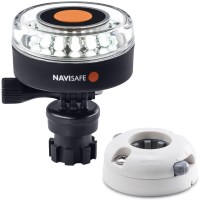
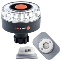
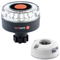
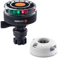
Navisafe Navilight Tricolor 2NM w/Navimount Base
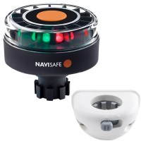
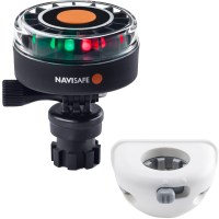
Navisafe Navilight Tricolor 2NM w/Navibolt Base & Vertical Mount - White
Navisafe Navilight Tricolor 2NM w/Navibolt Base & RIB Mount - White
Navisafe Navilight Tricolor 2NM w/Navibolt Base & RIB Mount - Black
Navisafe Navilight Tricolor 2NM w/Navibolt Base & Rail Mount - White
Navisafe Navilight Tricolor 2NM w/Navibolt Base & Rail Mount - Black
Navisafe Navilight Tricolor 2NM w/Navibolt Base & Horizontal Mount - White
Navisafe Navilight Tricolor 2NM w/Navibolt Base & Horizontal Mount - Black
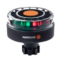
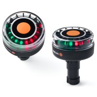
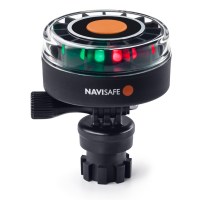
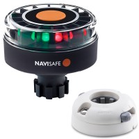
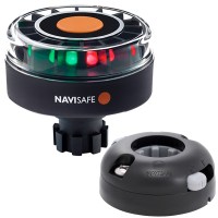
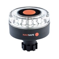
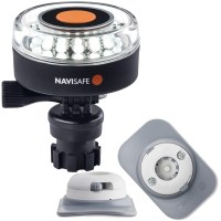
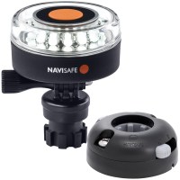
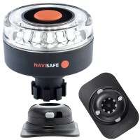
Navisafe Navilight Tricolor 2NM w/Navibolt Base
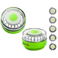
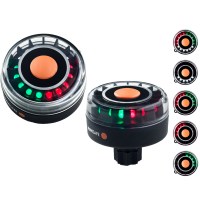
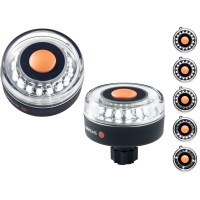
Navisafe Navilight All-White 5 Mode 360° Rescue 2NM w/Green Magnet Base
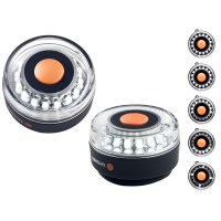
Navisafe Navilight All-White 5 Mode 360° 2NM w/RAILBLAZA Base
Navisafe Navilight All-White 5 Mode 360° 2NM w/Navimount Base
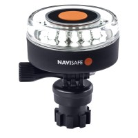
Navisafe Navilight All-White 5 Mode 360° 2NM w/Navibolt Base
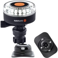
Navisafe Navilight All-White 5 Mode 360° 2NM w/Magnet Base
Navisafe Navilight 360° 2NM White w/Navimount Base & Vertical Mount - White
Navisafe Navilight 360° 2NM White w/Navimount Base & RIB Mount - White
Navisafe Navilight 360° 2NM White w/Navimount Base & RIB Mount - Black
Navisafe Navilight 360° 2NM White w/Navimount Base & Rail Mount - White
Navisafe Navilight 360° 2NM White w/Navimount Base & Rail Mount - Black
Navisafe Navilight 360° 2NM White w/Navimount Base & Horizontal Mount - White
Navisafe Navilight 360° 2NM White w/Navimount Base & Horizontal Mount - Black
Navisafe Navilight 360° 2NM w/Navibolt Base & Vertical Mount - White
Navisafe Navilight 360° 2NM w/Navibolt Base & RIB Mount - White
Navisafe Navilight 360° 2NM w/Navibolt Base & RIB Mount - Black
Navisafe Navilight 360° 2NM w/Navibolt Base & Rail Mount - White
Navisafe Navilight 360° 2NM w/Navibolt Base & Rail Mount - Black
Navisafe Navilight 360° 2NM w/Navibolt Base & Horizontal Mount - White
Navisafe Navilight 360° 2NM w/Navibolt Base & Horizontal Mount - Black
Navisafe Navilight 2NM Tricolor w/Navimount Base & Vertical Mount - White
Navisafe Navilight 2NM Tricolor w/Navimount Base & RIB Mount - White
Navisafe Navilight 2NM Tricolor w/Navimount Base & RIB Mount - Black
Navisafe Navilight 2NM Tricolor w/Navimount Base & Rail Mount - White
Navisafe Navilight 2NM Tricolor w/Navimount Base & Rail Mount - Black
Navisafe Navilight 2NM Tricolor w/Navimount Base & Horizontal Mount - White
Navisafe Navilight 2NM Tricolor w/Navimount Base & Horizontal Mount - Black
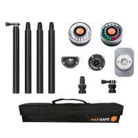
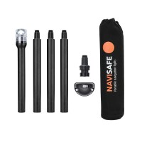
Navisafe Inflatable Skiff & Dinghy Complete Kit
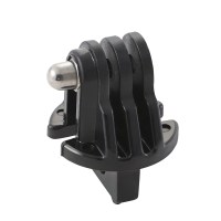
Navisafe GoPro FCS Mount f/Navimount Lights w/GoPro Base
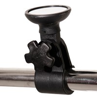
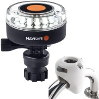
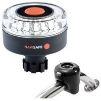
Navisafe Clamp-On Rail Mount Fits On 1" & 1-1/4" Rails
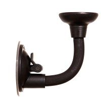
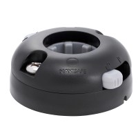
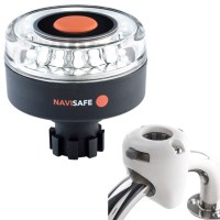
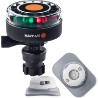
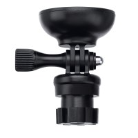
Navisafe Bendable Suction Cup Base Mount w/Mounting Disc
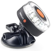
Navisafe All-White 5 Mode 360° 2NM w/Suction Base
Navisafe 3M VHB 3.5" Self-Adhesive Mounting Pad 2-Pack f/Suction Cup
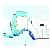
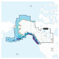
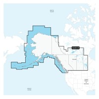
Navionics+ 010-C146740 Platinum+ Canada, West & Alaska Chart - 010-C1467-40 - 155-010C146740F1
Navionics Platinum+ Canada, West & Alaska -Lakes, Rivers and Coastal Marine Chart. Platinum+ additional features include: High resolution relief shading and satellite imagery, sonar imagery, aerial photography and 3D view.Includes a one-year subscription to Daily Updates and advanced features. After a year, renew at a discounted price.Visit Navionics website for full feature list, coverage details and compatibility of Navionics+ content and features with your GPS chartplotter.**NOT COMPATIBLE with GARMIN GPS chartplotters*
Navionics+ 010-C146730 Canada, West & Alaska Chart - 010-C1467-30 - 155-010C146730F1
Navionics+ Canada, West & Alaska -Lakes, Rivers and Coastal Marine Chart. Includes a one-year subscription to Daily Updates and advanced features. After a year, renew at a discounted priceVisit Navionics website for full feature list, coverage details and compatibility of Navionics+ content and features with your GPS chartplotter.**NOT COMPATIBLE with GARMIN GPS chartplotters*
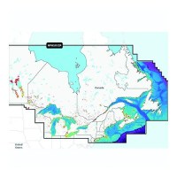
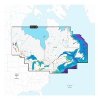
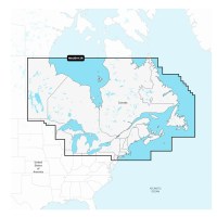
Navionics+ 010-C146640 Platinum+Canada, East & Great Lakes Chart - 010-C1466-40 - 155-010C146640F1
Navionics Platinum+ Canada, East & Great Lakes -Lakes, Rivers and Coastal Marine Chart. Platinum+ additinal features include: High resolution relief shading and satellite imagery, sonar imagery, aerial photography and 3D view.Includes a one-year subscription to Daily Updates and advanced features. After a year, renew at a discounted price.Visit Navionics website for full feature list, coverage details and compatibility of Navionics+ content and features with your GPS chartplotter.**NOT COMPATIBLE with GARMIN GPS chartplotters*
Navionics+ 010-C146630 Canada, East & Great Lakes Chart - 010-C1466-30 - 155-010C146630F1
Navionics+ Canada, East & Great Lakes -Lakes, Rivers and Coastal Marine Chart. Includes a one-year subscription to Daily Updates and advanced features. After a year, renew at a discounted priceVisit Navionics website for full feature list, coverage details and compatibility of Navionics+ content and features with your GPS chartplotter.**NOT COMPATIBLE with GARMIN GPS chartplotters*
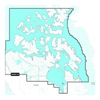
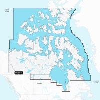
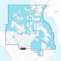
Navionics+ 010-C146230 Canada North Chart - 010-C1462-30 - 155-010C146230F1
Navionics+ Canada, Canada North-Lakes, Rivers and Coastal Marine Chart. Includes a one-year subscription to Daily Updates and advanced features. After a year, renew at a discounted priceVisit Navionics website for full feature list, coverage details and compatibility of Navionics+ content and features with your GPS chartplotter.**NOT COMPATIBLE with GARMIN GPS chartplotters*
Navionics Platinum+ NPUS012R - Canada, East & Great Lakes
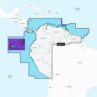
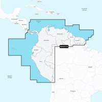
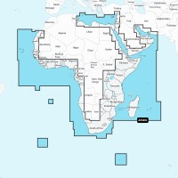
Navionics Platinum+ NPSA011R - South America North
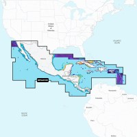
Navionics Platinum+ NPSA010R - Central America & Caribbean

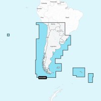
Navionics Platinum+ NPSA005L - Chile, Argentina & Easter Island
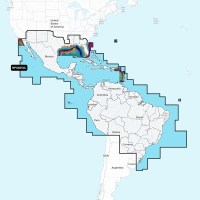
Navionics Platinum+ NPSA004L - Mexico, Caribbean to Brazil
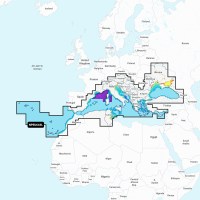
Navionics NPEU643L - Mediterranean & Black Sea - Navionics Platinum+
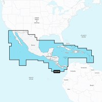
Navionics NASA010R - Central America & Caribbean - Navionics+
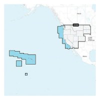
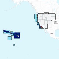
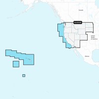
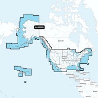
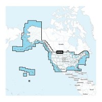
Navionics 010C137140 Platinum+ Cartography, U.S. West - 010-C1371-40 - 155-010C137140F1
THE NAVIONICS SUBSCRIPTION: A one-year subscription to Daily Updates and advanced features is included when you purchase any new Navionics Platinum+ mapping solution. After a year, you can renew at a discounted price CHARTS AND UPDATES:Nautical Chart - Comprehensive charts are derived from multiple official, government and private sources, displayed in a familiar look and feelSonarChart HD Bathymetry - Innovative 1' (0.5 m) bathymetry charts are created by using Navionics proprietary systems that augment existing content with sonar data contributed by the boating communityCommunity Edits - Get useful local knowledge from edits made by users of the Navionics Boating app on your compatible smart device.Daily Updates - Up to 5,000 daily updates to our charts give you the most accurate, most current Navionics data availableInland Content: 42,000+ lakes (varies by coverage area) ADVANCED FEATURES:Dock-to-dock Route Guidance - Start your trip with a suggested pathSonarChart Live Mapping Feature - Watch new HD depth maps develop in real time as your boat moves through the waterAdvanced Map Options - Customize your view to focus on the details that matter mostPlotter Sync - Transfer routes and markers, update chart layers and more - between your compatible chartplotter and the Boating app OVERLAYS:Relief Shading - Get an easy-to-interpret, clearer view of bottom structure. Check coverageSatellite Imagery with SonarChart Shading Overlay - Experience an enhanced awareness above and below the waterline. Check coverageSonar Imagery - View bottom hardness clearly and in contrasting color PLATINUM+ ADDITIONAL VIEWING OPTIONS:3D View - Adjust the perspective of your chart view to highlight key features and enhance awarenessAerial Photos - Get a better sense of your surroundingsVisit Navionics website for full feature list, coverage details and compatibility of Platinum+ content and features with your GPS chartplotter.**NOT COMPATIBLE with GARMIN GPS chartplotters**
Navionics 010C137130 Navionics+ Cartography, U.S. West - 010-C1371-30 - 155-010C137130F1
THE NAVIONICS SUBSCRIPTION: A one-year subscription to Daily Updates and advanced features is included when you purchase any Navionics+ mapping solution. After a year, you can renew at a discounted price.CHARTS AND UPDATES:Nautical Chart - Comprehensive charts are derived from multiple official, government and private sources, displayed in a familiar look and feel.SonarChart HD Bathymetry - Innovative 1' (0.5 m) bathymetry charts are created by using Navionics proprietary systems that augment existing content with sonar data contributed by the boating community.Community Edits - Get useful local knowledge from edits made by users of the Navionics Boating app on your compatible smart device.Daily Updates - Up to 5,000 daily updates to our charts give you the most accurate, most current data availableInland Content: 42,000+ lakes (varies by coverage area)ADVANCED FEATURES:Dock-to-dock Route Guidance - Start your trip with a suggested dock-to-dock route.Advanced Map Options - Customize your view to focus on the details that matter most.Plotter Sync - Transfer routes and markers, update chart layers and more - between your compatible chartplotter and the Boating app.SonarChart Live Mapping Feature - Watch new HD depth maps develop in real time as your boat moves through the water. Visit Navionics website for full feature list, coverage details and compatibility of Navionics+ content and features with your GPS chartplotter. **NOT COMPATIBLE with GARMIN GPS chartplotters**
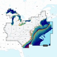
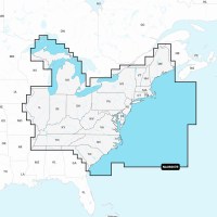
Navionics 010C137040 Platinum+ Cartography, U.S. East - 010-C1370-40 - 155-010C137040F1
THE NAVIONICS SUBSCRIPTION: A one-year subscription to Daily Updates and advanced features is included when you purchase any new Navionics Platinum+ mapping solution. After a year, you can renew at a discounted price CHARTS AND UPDATES:Nautical Chart - Comprehensive charts are derived from multiple official, government and private sources, displayed in a familiar look and feelSonarChart HD Bathymetry - Innovative 1' (0.5 m) bathymetry charts are created by using Navionics proprietary systems that augment existing content with sonar data contributed by the boating communityCommunity Edits - Get useful local knowledge from edits made by users of the Navionics Boating app on your compatible smart device.Daily Updates - Up to 5,000 daily updates to our charts give you the most accurate, most current Navionics data availableInland Content: 42,000+ lakes (varies by coverage area) ADVANCED FEATURES:Dock-to-dock Route Guidance - Start your trip with a suggested pathSonarChart Live Mapping Feature - Watch new HD depth maps develop in real time as your boat moves through the waterAdvanced Map Options - Customize your view to focus on the details that matter mostPlotter Sync - Transfer routes and markers, update chart layers and more - between your compatible chartplotter and the Boating app OVERLAYS:Relief Shading - Get an easy-to-interpret, clearer view of bottom structure. Check coverageSatellite Imagery with SonarChart Shading Overlay - Experience an enhanced awareness above and below the waterline. Check coverageSonar Imagery - View bottom hardness clearly and in contrasting color PLATINUM+ ADDITIONAL VIEWING OPTIONS:3D View - Adjust the perspective of your chart view to highlight key features and enhance awarenessAerial Photos - Get a better sense of your surroundingsVisit Navionics website for full feature list, coverage details and compatibility of Platinum+ content and features with your GPS chartplotter.**NOT COMPATIBLE with GARMIN GPS chartplotters**
Navionics 010C137030 Navionics+ Cartography, U.S. East - 010-C1370-30 - 155-010C137030F1
THE NAVIONICS SUBSCRIPTION: A one-year subscription to Daily Updates and advanced features is included when you purchase any Navionics+ mapping solution. After a year, you can renew at a discounted price.CHARTS AND UPDATES:Nautical Chart - Comprehensive charts are derived from multiple official, government and private sources, displayed in a familiar look and feel.SonarChart HD Bathymetry - Innovative 1' (0.5 m) bathymetry charts are created by using Navionics proprietary systems that augment existing content with sonar data contributed by the boating community.Community Edits - Get useful local knowledge from edits made by users of the Navionics Boating app on your compatible smart device.Daily Updates - Up to 5,000 daily updates to our charts give you the most accurate, most current data availableInland Content: 42,000+ lakes (varies by coverage area)ADVANCED FEATURES:Dock-to-dock Route Guidance - Start your trip with a suggested dock-to-dock route.Advanced Map Options - Customize your view to focus on the details that matter most.Plotter Sync - Transfer routes and markers, update chart layers and more - between your compatible chartplotter and the Boating app.SonarChart Live Mapping Feature - Watch new HD depth maps develop in real time as your boat moves through the water. Visit Navionics website for full feature list, coverage details and compatibility of Navionics+ content and features with your GPS chartplotter. **NOT COMPATIBLE with GARMIN GPS chartplotters**
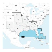
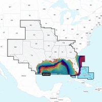
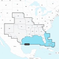
Navionics 010C136940 Platinum+ Cartography, U.S. South - 010-C1369-40 - 155-010C136940F1
THE NAVIONICS SUBSCRIPTION: A one-year subscription to Daily Updates and advanced features is included when you purchase any new Navionics Platinum+ mapping solution. After a year, you can renew at a discounted price CHARTS AND UPDATES:Nautical Chart - Comprehensive charts are derived from multiple official, government and private sources, displayed in a familiar look and feelSonarChart HD Bathymetry - Innovative 1' (0.5 m) bathymetry charts are created by using Navionics proprietary systems that augment existing content with sonar data contributed by the boating communityCommunity Edits - Get useful local knowledge from edits made by users of the Navionics Boating app on your compatible smart device.Daily Updates - Up to 5,000 daily updates to our charts give you the most accurate, most current Navionics data availableInland Content: 42,000+ lakes (varies by coverage area) ADVANCED FEATURES:Dock-to-dock Route Guidance - Start your trip with a suggested pathSonarChart Live Mapping Feature - Watch new HD depth maps develop in real time as your boat moves through the waterAdvanced Map Options - Customize your view to focus on the details that matter mostPlotter Sync - Transfer routes and markers, update chart layers and more - between your compatible chartplotter and the Boating app OVERLAYS:Relief Shading - Get an easy-to-interpret, clearer view of bottom structure. Check coverageSatellite Imagery with SonarChart Shading Overlay - Experience an enhanced awareness above and below the waterline. Check coverageSonar Imagery - View bottom hardness clearly and in contrasting color PLATINUM+ ADDITIONAL VIEWING OPTIONS:3D View - Adjust the perspective of your chart view to highlight key features and enhance awarenessAerial Photos - Get a better sense of your surroundingsVisit Navionics website for full feature list, coverage details and compatibility of Platinum+ content and features with your GPS chartplotter.**NOT COMPATIBLE with GARMIN GPS chartplotters**
Navionics 010C136930 Navionics+ Cartography, U.S. South - 010-C1369-30 - 155-010C136930F1
THE NAVIONICS SUBSCRIPTION: A one-year subscription to Daily Updates and advanced features is included when you purchase any Navionics+ mapping solution. After a year, you can renew at a discounted price.CHARTS AND UPDATES:Nautical Chart - Comprehensive charts are derived from multiple official, government and private sources, displayed in a familiar look and feel.SonarChart HD Bathymetry - Innovative 1' (0.5 m) bathymetry charts are created by using Navionics proprietary systems that augment existing content with sonar data contributed by the boating community.Community Edits - Get useful local knowledge from edits made by users of the Navionics Boating app on your compatible smart device.Daily Updates - Up to 5,000 daily updates to our charts give you the most accurate, most current data availableInland Content: 42,000+ lakes (varies by coverage area)ADVANCED FEATURES:Dock-to-dock Route Guidance - Start your trip with a suggested dock-to-dock route.Advanced Map Options - Customize your view to focus on the details that matter most.Plotter Sync - Transfer routes and markers, update chart layers and more - between your compatible chartplotter and the Boating app.SonarChart Live Mapping Feature - Watch new HD depth maps develop in real time as your boat moves through the water. Visit Navionics website for full feature list, coverage details and compatibility of Navionics+ content and features with your GPS chartplotter. **NOT COMPATIBLE with GARMIN GPS chartplotters**

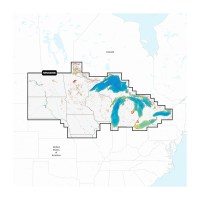
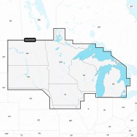
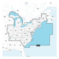
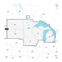
Navionics 010C136840 Platinum+ Cartography, U.S. North - 010-C1368-40 - 155-010C136840F1
THE NAVIONICS SUBSCRIPTION: A one-year subscription to Daily Updates and advanced features is included when you purchase any new Navionics Platinum+ mapping solution. After a year, you can renew at a discounted price CHARTS AND UPDATES:Nautical Chart - Comprehensive charts are derived from multiple official, government and private sources, displayed in a familiar look and feelSonarChart HD Bathymetry - Innovative 1' (0.5 m) bathymetry charts are created by using Navionics proprietary systems that augment existing content with sonar data contributed by the boating communityCommunity Edits - Get useful local knowledge from edits made by users of the Navionics Boating app on your compatible smart device.Daily Updates - Up to 5,000 daily updates to our charts give you the most accurate, most current Navionics data availableInland Content: 42,000+ lakes (varies by coverage area) ADVANCED FEATURES:Dock-to-dock Route Guidance - Start your trip with a suggested pathSonarChart Live Mapping Feature - Watch new HD depth maps develop in real time as your boat moves through the waterAdvanced Map Options - Customize your view to focus on the details that matter mostPlotter Sync - Transfer routes and markers, update chart layers and more - between your compatible chartplotter and the Boating app OVERLAYS:Relief Shading - Get an easy-to-interpret, clearer view of bottom structure. Check coverageSatellite Imagery with SonarChart Shading Overlay - Experience an enhanced awareness above and below the waterline. Check coverageSonar Imagery - View bottom hardness clearly and in contrasting color PLATINUM+ ADDITIONAL VIEWING OPTIONS:3D View - Adjust the perspective of your chart view to highlight key features and enhance awarenessAerial Photos - Get a better sense of your surroundingsVisit Navionics website for full feature list, coverage details and compatibility of Platinum+ content and features with your GPS chartplotter.**NOT COMPATIBLE with GARMIN GPS chartplotters**
Navionics 010C136830 Navionics+ Cartography, U.S. North - 010-C1368-30 - 155-010C136830F1
THE NAVIONICS SUBSCRIPTION: A one-year subscription to Daily Updates and advanced features is included when you purchase any Navionics+ mapping solution. After a year, you can renew at a discounted price.CHARTS AND UPDATES:Nautical Chart - Comprehensive charts are derived from multiple official, government and private sources, displayed in a familiar look and feel.SonarChart HD Bathymetry - Innovative 1' (0.5 m) bathymetry charts are created by using Navionics proprietary systems that augment existing content with sonar data contributed by the boating community.Community Edits - Get useful local knowledge from edits made by users of the Navionics Boating app on your compatible smart device.Daily Updates - Up to 5,000 daily updates to our charts give you the most accurate, most current data availableInland Content: 42,000+ lakes (varies by coverage area)ADVANCED FEATURES:Dock-to-dock Route Guidance - Start your trip with a suggested dock-to-dock route.Advanced Map Options - Customize your view to focus on the details that matter most.Plotter Sync - Transfer routes and markers, update chart layers and more - between your compatible chartplotter and the Boating app.SonarChart Live Mapping Feature - Watch new HD depth maps develop in real time as your boat moves through the water. Visit Navionics website for full feature list, coverage details and compatibility of Navionics+ content and features with your GPS chartplotter. **NOT COMPATIBLE with GARMIN GPS chartplotters**
Navionics 010C136630 Navionics+ Cartography, U.S. & Coastal Canada - 010-C1366-30 - 155-010C136630F1
THE NAVIONICS SUBSCRIPTION: A one-year subscription to Daily Updates and advanced features is included when you purchase any Navionics+ mapping solution. After a year, you can renew at a discounted price.CHARTS AND UPDATES:Nautical Chart - Comprehensive charts are derived from multiple official, government and private sources, displayed in a familiar look and feel.SonarChart HD Bathymetry - Innovative 1' (0.5 m) bathymetry charts are created by using Navionics proprietary systems that augment existing content with sonar data contributed by the boating community.Community Edits - Get useful local knowledge from edits made by users of the Navionics Boating app on your compatible smart device.Daily Updates - Up to 5,000 daily updates to our charts give you the most accurate, most current data availableInland Content: 42,000+ lakes (varies by coverage area)ADVANCED FEATURES:Dock-to-dock Route Guidance - Start your trip with a suggested dock-to-dock route.Advanced Map Options - Customize your view to focus on the details that matter most.Plotter Sync - Transfer routes and markers, update chart layers and more - between your compatible chartplotter and the Boating app.SonarChart Live Mapping Feature - Watch new HD depth maps develop in real time as your boat moves through the water. Visit Navionics website for full feature list, coverage details and compatibility of Navionics+ content and features with your GPS chartplotter. **NOT COMPATIBLE with GARMIN GPS chartplotters**
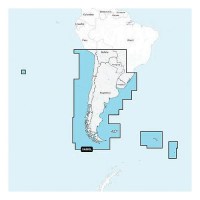
Navionics 010C136540 Platinum+ Cartography, Chile, Argentina & Easter Island - 010-C1365-40 - 155-010C136540F1
THE NAVIONICS SUBSCRIPTION: A one-year subscription to Daily Updates and advanced features is included when you purchase any new Navionics Platinum+ mapping solution. After a year, you can renew at a discounted price CHARTS AND UPDATES:Nautical Chart - Comprehensive charts are derived from multiple official, government and private sources, displayed in a familiar look and feelSonarChart HD Bathymetry - Innovative 1' (0.5 m) bathymetry charts are created by using Navionics proprietary systems that augment existing content with sonar data contributed by the boating communityCommunity Edits - Get useful local knowledge from edits made by users of the Navionics Boating app on your compatible smart device.Daily Updates - Up to 5,000 daily updates to our charts give you the most accurate, most current Navionics data availableInland Content: 42,000+ lakes (varies by coverage area) ADVANCED FEATURES:Dock-to-dock Route Guidance - Start your trip with a suggested pathSonarChart Live Mapping Feature - Watch new HD depth maps develop in real time as your boat moves through the waterAdvanced Map Options - Customize your view to focus on the details that matter mostPlotter Sync - Transfer routes and markers, update chart layers and more - between your compatible chartplotter and the Boating app OVERLAYS:Relief Shading - Get an easy-to-interpret, clearer view of bottom structure. Check coverageSatellite Imagery with SonarChart Shading Overlay - Experience an enhanced awareness above and below the waterline. Check coverageSonar Imagery - View bottom hardness clearly and in contrasting color PLATINUM+ ADDITIONAL VIEWING OPTIONS:3D View - Adjust the perspective of your chart view to highlight key features and enhance awarenessAerial Photos - Get a better sense of your surroundingsVisit Navionics website for full feature list, coverage details and compatibility of Platinum+ content and features with your GPS chartplotter.**NOT COMPATIBLE with GARMIN GPS chartplotters**
Navionics 010C136530 Navionics+ Cartography, Chile, Argentina & Easter Island - 010-C1365-30 - 155-010C136530F1
THE NAVIONICS SUBSCRIPTION: A one-year subscription to Daily Updates and advanced features is included when you purchase any Navionics+ mapping solution. After a year, you can renew at a discounted price.CHARTS AND UPDATES:Nautical Chart - Comprehensive charts are derived from multiple official, government and private sources, displayed in a familiar look and feel.SonarChart HD Bathymetry - Innovative 1' (0.5 m) bathymetry charts are created by using Navionics proprietary systems that augment existing content with sonar data contributed by the boating community.Community Edits - Get useful local knowledge from edits made by users of the Navionics Boating app on your compatible smart device.Daily Updates - Up to 5,000 daily updates to our charts give you the most accurate, most current data availableInland Content: 42,000+ lakes (varies by coverage area)ADVANCED FEATURES:Dock-to-dock Route Guidance - Start your trip with a suggested dock-to-dock route.Advanced Map Options - Customize your view to focus on the details that matter most.Plotter Sync - Transfer routes and markers, update chart layers and more - between your compatible chartplotter and the Boating app.SonarChart Live Mapping Feature - Watch new HD depth maps develop in real time as your boat moves through the water. Visit Navionics website for full feature list, coverage details and compatibility of Navionics+ content and features with your GPS chartplotter. **NOT COMPATIBLE with GARMIN GPS chartplotters**
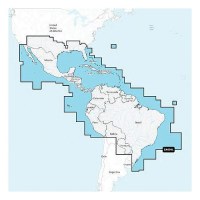
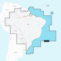
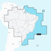
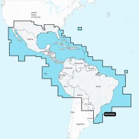
Navionics 010C136440 Platinum+ Cartography, Mexico, Caribbean To Brazil - 010-C1364-40 - 155-010C136440F1
THE NAVIONICS SUBSCRIPTION: A one-year subscription to Daily Updates and advanced features is included when you purchase any new Navionics Platinum+ mapping solution. After a year, you can renew at a discounted price CHARTS AND UPDATES:Nautical Chart - Comprehensive charts are derived from multiple official, government and private sources, displayed in a familiar look and feelSonarChart HD Bathymetry - Innovative 1' (0.5 m) bathymetry charts are created by using Navionics proprietary systems that augment existing content with sonar data contributed by the boating communityCommunity Edits - Get useful local knowledge from edits made by users of the Navionics Boating app on your compatible smart device.Daily Updates - Up to 5,000 daily updates to our charts give you the most accurate, most current Navionics data availableInland Content: 42,000+ lakes (varies by coverage area) ADVANCED FEATURES:Dock-to-dock Route Guidance - Start your trip with a suggested pathSonarChart Live Mapping Feature - Watch new HD depth maps develop in real time as your boat moves through the waterAdvanced Map Options - Customize your view to focus on the details that matter mostPlotter Sync - Transfer routes and markers, update chart layers and more - between your compatible chartplotter and the Boating app OVERLAYS:Relief Shading - Get an easy-to-interpret, clearer view of bottom structure. Check coverageSatellite Imagery with SonarChart Shading Overlay - Experience an enhanced awareness above and below the waterline. Check coverageSonar Imagery - View bottom hardness clearly and in contrasting color PLATINUM+ ADDITIONAL VIEWING OPTIONS:3D View - Adjust the perspective of your chart view to highlight key features and enhance awarenessAerial Photos - Get a better sense of your surroundingsVisit Navionics website for full feature list, coverage details and compatibility of Platinum+ content and features with your GPS chartplotter.**NOT COMPATIBLE with GARMIN GPS chartplotters**
Navionics 010C136430 Navionics+ Cartography, Mexico, Caribbean To Brazil - 010-C1364-30 - 155-010C136430F1
THE NAVIONICS SUBSCRIPTION: A one-year subscription to Daily Updates and advanced features is included when you purchase any Navionics+ mapping solution. After a year, you can renew at a discounted price.CHARTS AND UPDATES:Nautical Chart - Comprehensive charts are derived from multiple official, government and private sources, displayed in a familiar look and feel.SonarChart HD Bathymetry - Innovative 1' (0.5 m) bathymetry charts are created by using Navionics proprietary systems that augment existing content with sonar data contributed by the boating community.Community Edits - Get useful local knowledge from edits made by users of the Navionics Boating app on your compatible smart device.Daily Updates - Up to 5,000 daily updates to our charts give you the most accurate, most current data availableInland Content: 42,000+ lakes (varies by coverage area)ADVANCED FEATURES:Dock-to-dock Route Guidance - Start your trip with a suggested dock-to-dock route.Advanced Map Options - Customize your view to focus on the details that matter most.Plotter Sync - Transfer routes and markers, update chart layers and more - between your compatible chartplotter and the Boating app.SonarChart Live Mapping Feature - Watch new HD depth maps develop in real time as your boat moves through the water. Visit Navionics website for full feature list, coverage details and compatibility of Navionics+ content and features with your GPS chartplotter. **NOT COMPATIBLE with GARMIN GPS chartplotters**